
One of the advantages of living on a small island is that cycling around the entirety of one’s country becomes a relatively easy feat. All it takes is covering about 150 km of flat terrain. I’ve made the journey around Singapore thrice so far, and it has become one of my favourite day trip adventures.
My starting point is Geylang which is convenient for being just a few minutes away from the coast at ECP (East Coast Park). The PCN (Park Connector) at ECP is one of the safest places to cycle in the dark. Starting early allows me to easily reach Changi or Pasir Ris to watch the sunrise on the beach, which is always a beautiful way to begin the day.
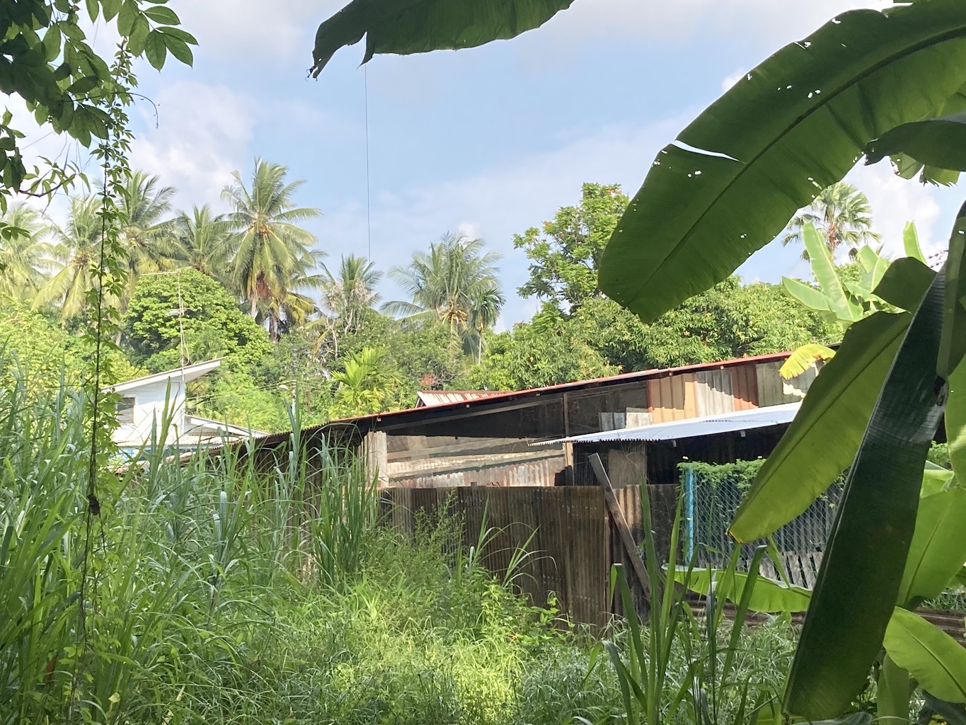
From Pasir Ris, I continue on another PCN, and make a quick detour across Coney Island, also known as Pulau Serangoon. In the 1950s, Indian businessman Ghulam Mahmood cooked up the idea to build a resort reminiscing the amusement park on New York’s Coney Island in Brooklyn. These plans never materialized, though, and today, Coney Island is a tranquil nature park instead.
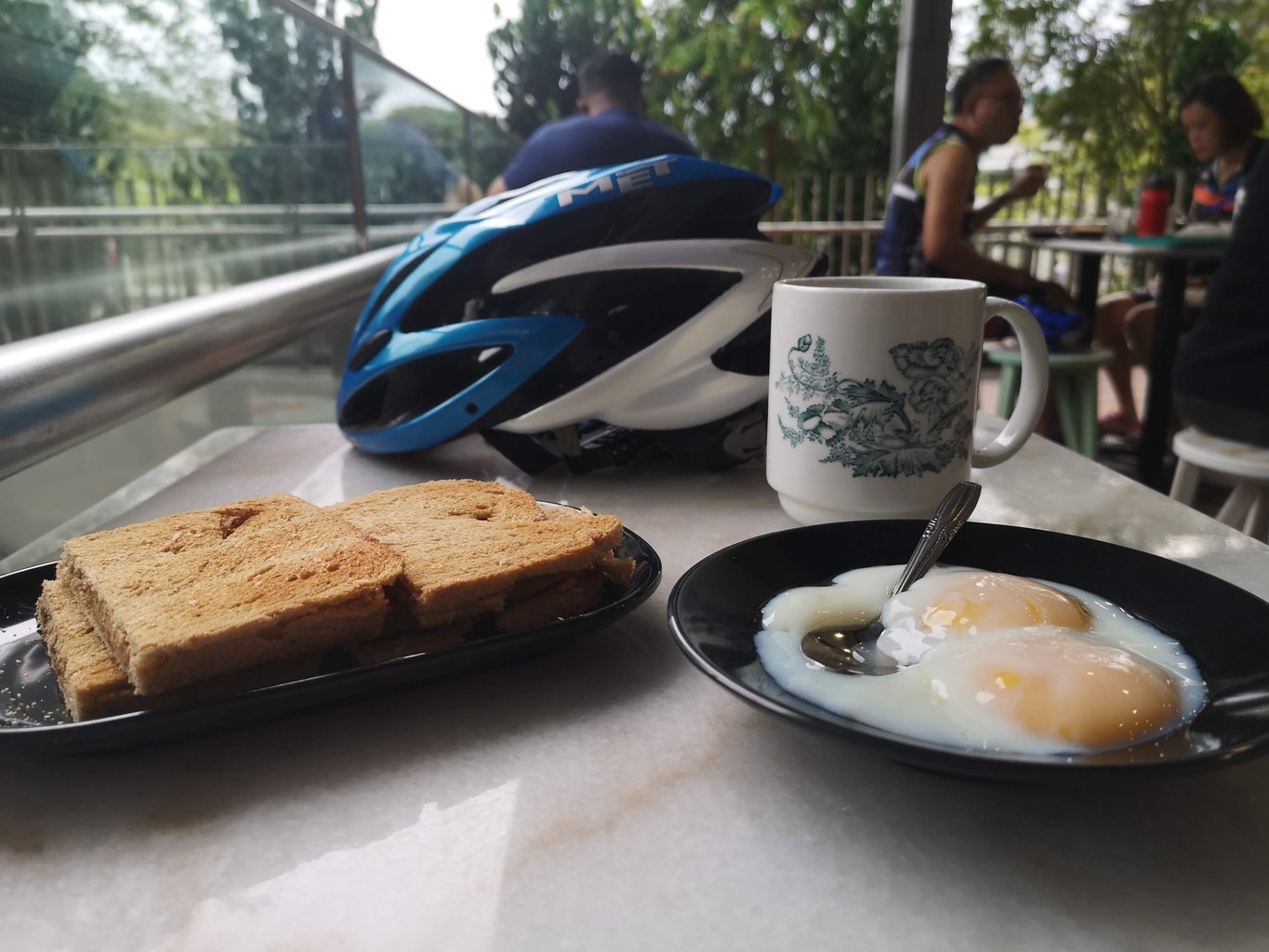
Opposite the island, Punggol is a good rest stop for breakfast. I usually sit outside at Waterway Point and enjoy a quick break in the morning sun. I have one of the classic Singapore breakfasts. Kaya toast, eggs and kopi never seem to get old. I wish I’d crave something healthier, but it doesn’t matter today, at least in terms of calories. I burn a lot, and I’m only getting started.
I don’t linger too long and soon step back on my bike, trying to cover as much distance as possible before the mid-day heat. A worthwhile detour from Punggol is further inland to Hougang. I visit Kampong Lorong Buangkok, Singapore’s last remaining kampong (village) before heading back North towards the coast.
The idea that Singapore is well connected for cyclists through park connectors can be misleading if you think of cycling as a form of exercise. Park connectors are a convenient and, for the most part, safe way to walk, jog, cycle or inline skate in Singapore, but they’re not tailored towards long uninterrupted, fast cycling. There are a few good stretches for that (the most extended and busiest along East Coast Park), but elsewhere, you’ll often find yourself stopping at a traffic light every few minutes as you connect from one park to the next, a routine that is seriously testing my patience.
While many park connectors have dedicated bicycle lanes, that doesn’t mean pedestrians won’t use them as well. In theory, moreover, bicycles, like cars, should stay on the left side. In reality, that’s not always the case either. In short, you have to keep alert at all times and going at speeds of 30 km/h or more is not always possible. There are ways to minimize these challenges. Many athletes cycle at night or very early in the morning. Others avoid park connectors altogether and ride on the roads instead which adds the extra risk of exposure to traffic, though.
I’ve decided to take a chill approach to all of this. I see these trips as a way to explore Singapore and not worry too much about kilometres, average speed and so on. I find worthy detours and breaks and almost always take the entire day to complete the loop while others aim to finish the whole journey before noon to avoid Singapore’s relentless sun.
Cruising through Seletar, I marvel at the colonial-era architecture. Soek Seng 1954 Bicycle Cafe is a popular rest stop located next to the runway of Seletar Airport. I’m usually here too early in the day, so, instead, I reach Rower's Bay Park and cross the dam into Yishun and Sembawang.
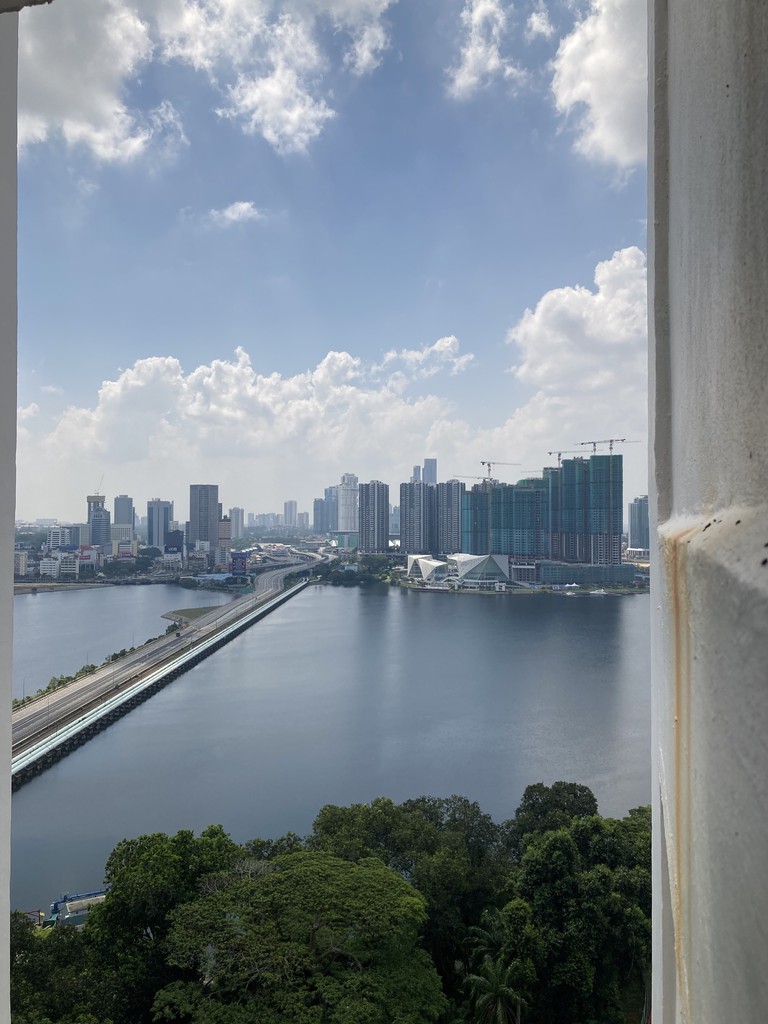
Singapore's only hot spring has re-opened after renovation in 2019 and is a short detour on the way to Woodlands. I dip my legs in the water before continuing to Admiralty and Woodlands Waterfront Park. I gaze at the skyline of Johor Bahru across the causeway. It’s here that during the pandemic border closure, Singaporeans have waved to friends and family on the other side of the causeway.
The first time I cycle here, the border is still open, and I contemplate crossing it for a lunch break in JB (Johor Bahru). I don’t bring my passport, though, so I have my meal at Rasa Istimewa, instead, a seafood restaurant located on the jetty as close to Malaysia as I can possibly get.
From Woodlands, there are a few options. I usually continue through Kranji towards Sungei Buloh. Crossing the damn over the Kranji Reservoir, I reach one of the most popular places in Singapore amongst cyclists. Well-paved roads, with fewer cars and almost no traffic lights, stretch across this part of the island.
The bird-watching tower in Sungei Buloh Wetlands Reserve is a pleasant rest spot and one of my favourite places in Singapore, particularly on weekdays when there’s a high chance that I’ll be the only one there, reading a book and enjoying the shade.
By now, it’s scorching hot. Sunscreen is a must; long sleeves help too (against the sun, not the heat). As the sweat keeps pouring, I make my way to Hay Dairies farm. Their goat milk popsicles are a must-try. Poison Ivy Bistro is an option for a lunch break and some rest. It’s a hidden gem located on a farm named Bollywood Veggies.
Lim Chu Kang cuts across the Western edge of Singapore and leads South past cemeteries on either side. There’s hardly any chance to escape the sun, the only shelters being a few desolate-looking bus stops. Traffic gets more, it can be dusty on the road, it’s likely hot, and, God beware, this is not a place to get stuck in a rainstorm. Never-ending Lim Chu Kang Road is usually where I briefly question my sanity. Why am I spending a tropical Singapore afternoon on a bicycle? The motto is to get through this stretch. Keep pedalling and don’t think too much.
There’s also a path on the far westernmost part of the island, leading straight down to Tuas and the Second Link bridge. However, the whole area is closed for military purposes. It’s possible to reach Tuas from the main road too, but, so far, I’ve never found it worth trying. By the time I get to Lim Chu Kang, I usually have my eyes set on returning home again.
From Woodlands, an alternative (and a bit shorter) loop that skips Lim Chu Kang, is turning South towards Choa Chu Kang and Bukit Gombak instead. This passes by Bukit Batok Town Park and beautiful 小桂林 Little Guilin, a former granite quarry which is said to resemble the famous rock formations in Guilin in China.
I cross Jurong West and Boon Lay, and cycle along Pandan Reservoir (a beautiful place to watch sunset but there’s no time today). The more enjoyable route leads slightly further North through Jurong East and Chinese Garden, but I prefer staying closer to the coastline. West Coast Park is an easy option to stop for some early dinner. I’ve rarely craved the sight of the famous golden arches more.
With renewed energy, it’s an easy roll into town via Labrador Park and Tanjong Pagar. Or it could be because there is a final worthy detour. From Harbour Front, I cross the bridge to Sentosa, a modern version of what Ghulam Mahmood must have envisioned to create on Serangoon (“Coney”) Island 70 years ago. I enjoy the hilliest part of my cycling trip, and not having to stop at countless traffic lights for a change. It’s a short de-tour and after returning to the mainland, I soon reach Tanjong Pagar.
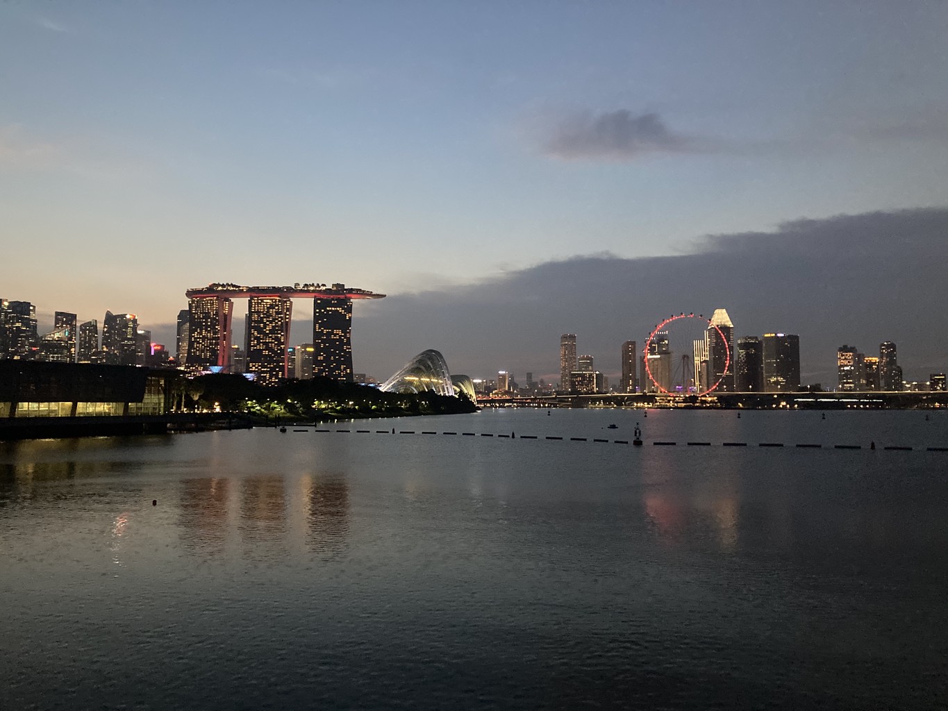
I pass by MBS (Marina Bay Sands) and navigate my way through crowded Gardens By The Bay. As the sun sets, I cross Marina Barrage to the East Side of Marina Bay. Here, Founder’s Memorial is planned to open in 2027 remembering the country’s founding fathers. Meanwhile, it is one of my favourite places to go for a run in Singapore.
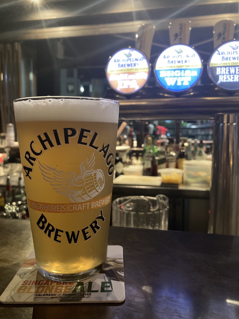
I arrive back home via Tanjong Rhu and Mountbatten. A good stretch, a pleasant cold(ish) shower and a beer (or two) at Tuckshop conclude the day, and I soon fall asleep dreaming of my next adventure. Maybe I could do this on a mountain bike next time and include Pulau Ubin as well.