

My watch shows 4:29pm and 30 seconds as I come down the final bend in the road. I’ve returned to the visitor centre with seconds to spare for our 4:30pm meet-up time. The others are ready to leave. Later, I learn I’ve been the only one reaching the peak today.
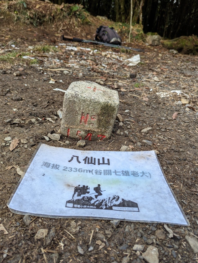
Our bus arrives at Baxianshan Visitor Centre around 9:45am. Eric, our Taiwanese guide, gives us a briefing before everyone goes their separate ways exploring the forest or trying to hike 1500 vertical meters up Baxianshan. It’s 2366 meters or 8000 Taiwanese feet (taichih) high, and its name is influenced by the Japanese pronunciation of 8000 (“basian”).
“If you don’t reach the peak by 1pm, you have to turn around to make it back in time”, Eric warns us. There’s plenty of time, so I contemplate a more ambitious route hiking up an alternative, somewhat unmaintained trail. It would lead me to Dongbaxianshang first and then Baxianshan before descending the main path back to the visitor centre.
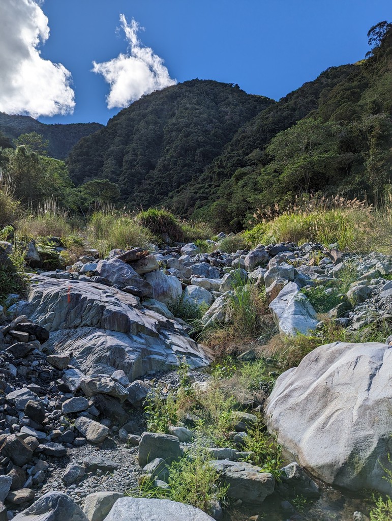
I quickly pass the warning sign at the entrance and find a well-trodden path leading deeper into the forest. After a few minutes, the first challenge is crossing a small ravine secured with ropes. This kind of difficulty feels odd on an otherwise easy trail. I soon discover the reason, a short wooden bridge resting pitiful a few meters below. I wonder what kind of storm or landslide caused it to end up there, but I neither want nor need to know.
I ignore this early warning sign and continue. The trail soon intersects 佳保溪 Jiabao creek. On this day, it’s a small stream trickling down the valley. I follow a sign that leads back into the woods but soon realize that it only marks the way to a small shelter and not further up the mountain. The vegetation grows thicker, and I decide to go back down to the river and follow the barely marked trail that leads up along it.
After some time, I contemplate my options. Following the stream is easy enough, but I don’t know how the trail will look in its later stages. In the worst case, I would need to return and descend on the same path, carefully navigating slippery rocks and river crossings. That might cut it uncomfortably tight for our 4:30pm meet-up time.
I decide to turn around. There should still be enough time to tackle Baxianshan via the main route. Overly concerned about missing where the path diverts from the river, I turn into the forest too early. Sharp plants slice into the skin on my arms as I push my way back out. The cuts aren’t deep, but they’re still visible reminders of this trip for some time.
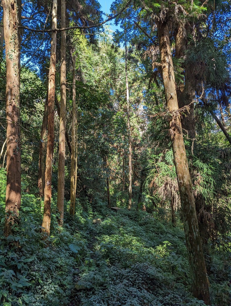
From the main trailhead, I quickly begin climbing, about 1.5 hours after everyone else. I soon begin to overtake the slower members of our group and those who have come to enjoy the forest with no intention of climbing to the top. There’s a sign every 500 meters along the 6-kilometre-long trail. I aim to cover that distance in 10 minutes, a pace that would bring me to the top in 2 hours. I soon learn this is optimistic thinking, and I must slow down a little to prevent over-pacing.
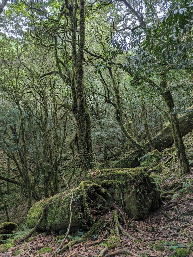
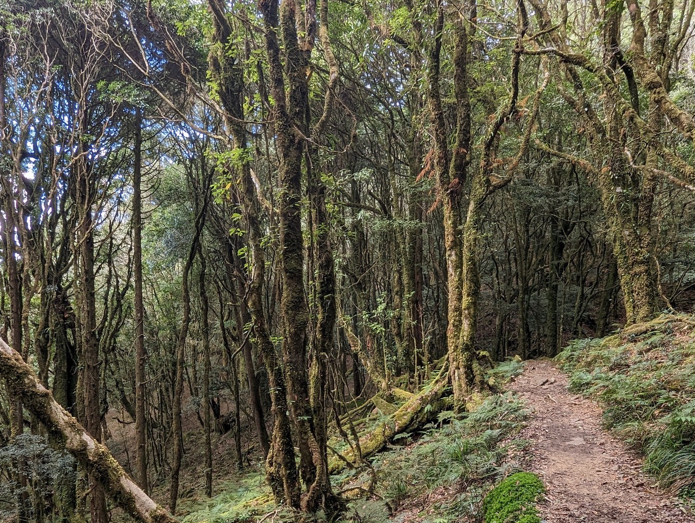
The sound of the river begins to fade. I put in earphones, turn on my favourite playlist and try to find my rhythm. Soon, I find time to appreciate my surroundings. The forest grows thicker the higher I climb; lush vegetation blends with the moss on the trees, some of which must be hundreds of years old. I’m reminded of Alishan, the seemingly endless hikes up the Luoma Ridge or Songluo Lake.
Honestly, I’ve never been a huge fan of hiking through the woods before, always preferring more rugged terrain and unobstructed views. Hiking in Taiwan has made me appreciate this type of nature. A particular kind of energy emanates from an ancient forest, its proud trees standing in patient silence and enduring the tiny intruders huffing and puffing up with their walking sticks.
There are a few flat sections, but for the most part, the trail is relentlessly upslope. It must be to cover 1500 vertical meters in a mere 6-kilometre length. After what felt like an eternity, I reach the last push to the highest point, which is still surrounded by trees on all sides. It’s a somewhat fitting peak for this type of hike as the lack of views doesn’t veer the attention off the beauty of the forest itself. There are a few large groups of hikers on top, and someone is quick to offer to take my picture.
I have a small snack and drink some water. It’s a few minutes after 2pm when I start descending. I’m more than an hour behind Eric’s schedule, but I’m not too worried. The way down is usually much faster than climbing up. Some sections need careful negotiation, though, and I soon realize there won’t be much time to spare. Like on the ascent, I aim to cover 500 meters in 10 minutes, and, again, I don’t quite reach that pace. I take my time where I have to, and I run on the flat portions in between.
My quads begin to revolt against my relentless pacing. It’s part reluctance of missing the bus and sleeping in the national park (if I can get a room, that is) and part my pride of not being late that push me down the trail.
If I (or you, dear reader) plan to go to Baxianshan again, drive up the night before. Start at 7am and enjoy a full day in the forest with plenty of time to explore it at a more leisurely pace.
We make it back to Taichung through the Saturday evening jam. Eric gives me a pat on the back as I climb out of the bus. “You’re my hero. I love you.” He seems happy for me and content that at least one of his group has seen the top of the mountain today.