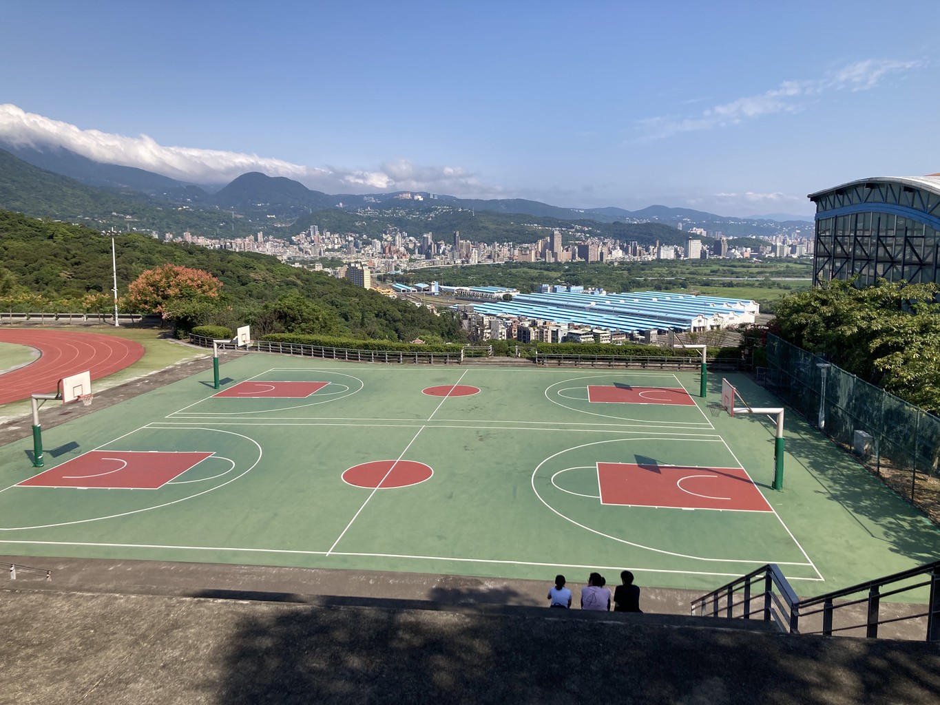
A unique outdoor experience in Taiwan is hiking the Taipei Grand Trail. It’s a 92-kilometre trail, reflecting the remarkable variety of the landscape around the nation’s capital. Made up of seven accessible sections with various options to extend or vary one’s journey, it’s a perfect opportunity to start your Taiwan hiking adventures.
I hiked the Grand Trail over multiple weekends between October and December 2021 (some of it multiple times). The following is a description of the trail in its entirety from North to South.
Stage 1
The starting point is 關渡 Guandu Station on the Tamsui-Xinye MRT line. From Exit 2, it’s a few minutes to the campus of the 台北藝術大學 National University of Arts.
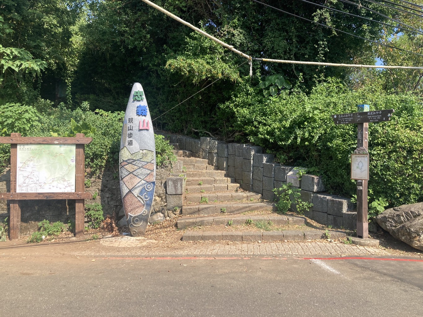
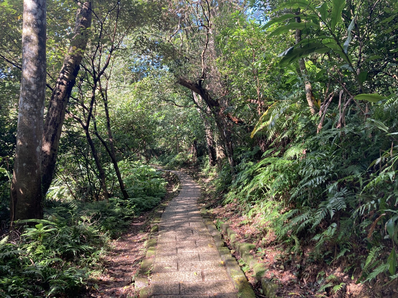
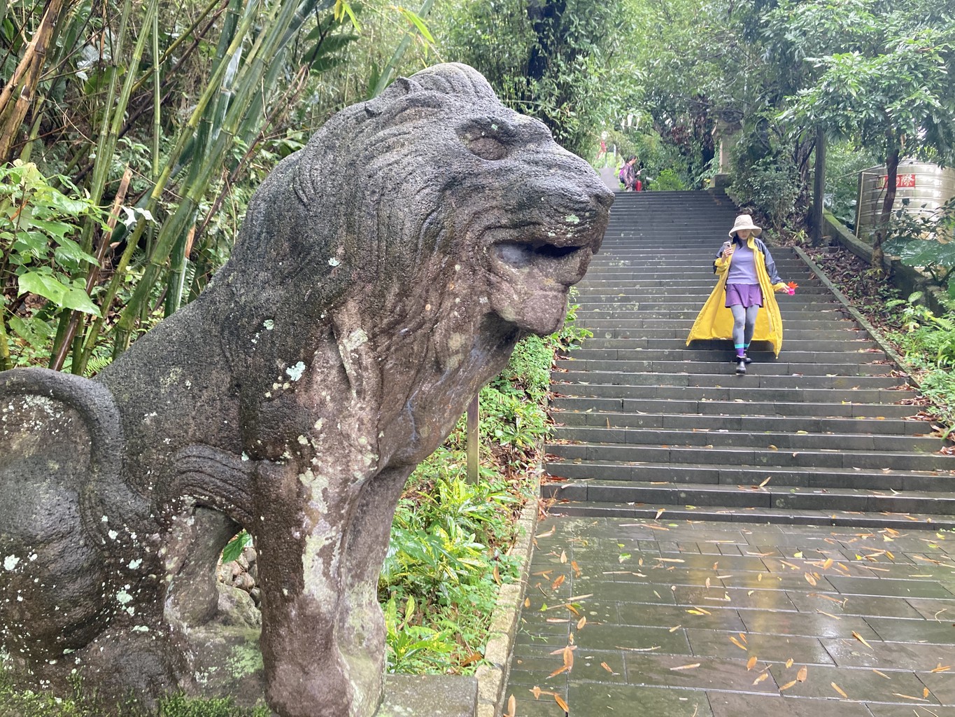
Strolling along a quiet avenue, I quickly feel far away from the bustle of the city. Behind the far end of the campus lies the entrance to the Zhongyishan trail. Small paths lead through a green forest up to 清天宮 Qingtian Temple (446 m). Over endless stone steps, a typical feature of many Taiwan hiking trails, I continue gaining altitude quickly.
At the fork near a small shelter at 面天坪 Miantian Ping (793 m), I stay on the main path to reach the parking lot and bus stop at 二子坪 Erziping (842 m). Alternatively, turning right leads to 大屯山 Datunshan, combining Stages 1 and 2 of the Taipei Grand Hike for a more challenging hike.
Stage 2
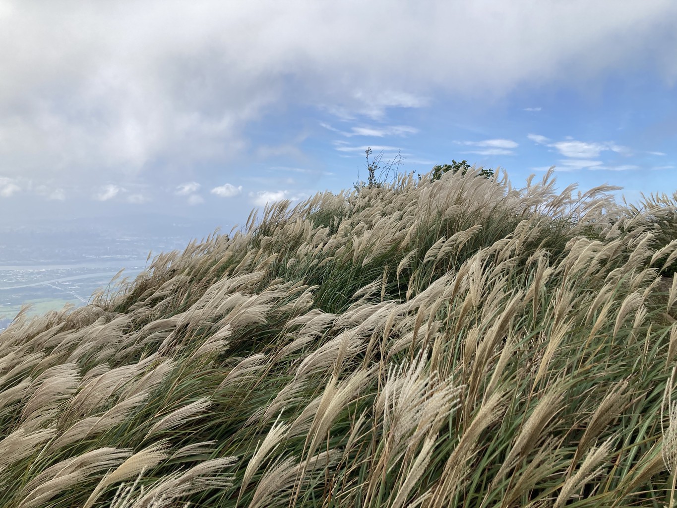
From Eriziping, I head back to the Miantian Ping Pavillon. From here, the trail narrows and steeply climbs through the forest to a ridge line. A thicket of silver grass, gently swaying in the wind, characterizes the rest of the way to the West (983 m), South (959 m) and Main (1092 m) peaks of Datunshan. It’s Taiwan’s only strata volcano and the second-highest mountain in 陽明山 Yangmingshan National Park.
During Japanese rule in the early 20th century, large parts of Yangmingshan fell victim to deforestation fires. Chinese reed, also known as silver grass, was one of the first plants to gain a foothold under these conditions. It still gives the area its typical character today.
From the viewing platform on top, which is also a popular stargazing location, I start walking down and proceed to the visitor centre at 小油坑 Xiaoyoukeng (791 m).
Sulfurous vapour rises to the surface from fumaroles. There is a faint smell of rotten eggs, a testament to the volcanic activity still present in Yangmingshan.
We won’t have to fear an eruption in the foreseeable future. Instead, locals and guests enjoy the benefits of the numerous hot springs in and around the National Park. You could suspect that bathing culture came to Taiwan with the Japanese occupation. However, a German businessman opened the first spa at the foot of today’s national park at the end of the 19th century.
Stage 3
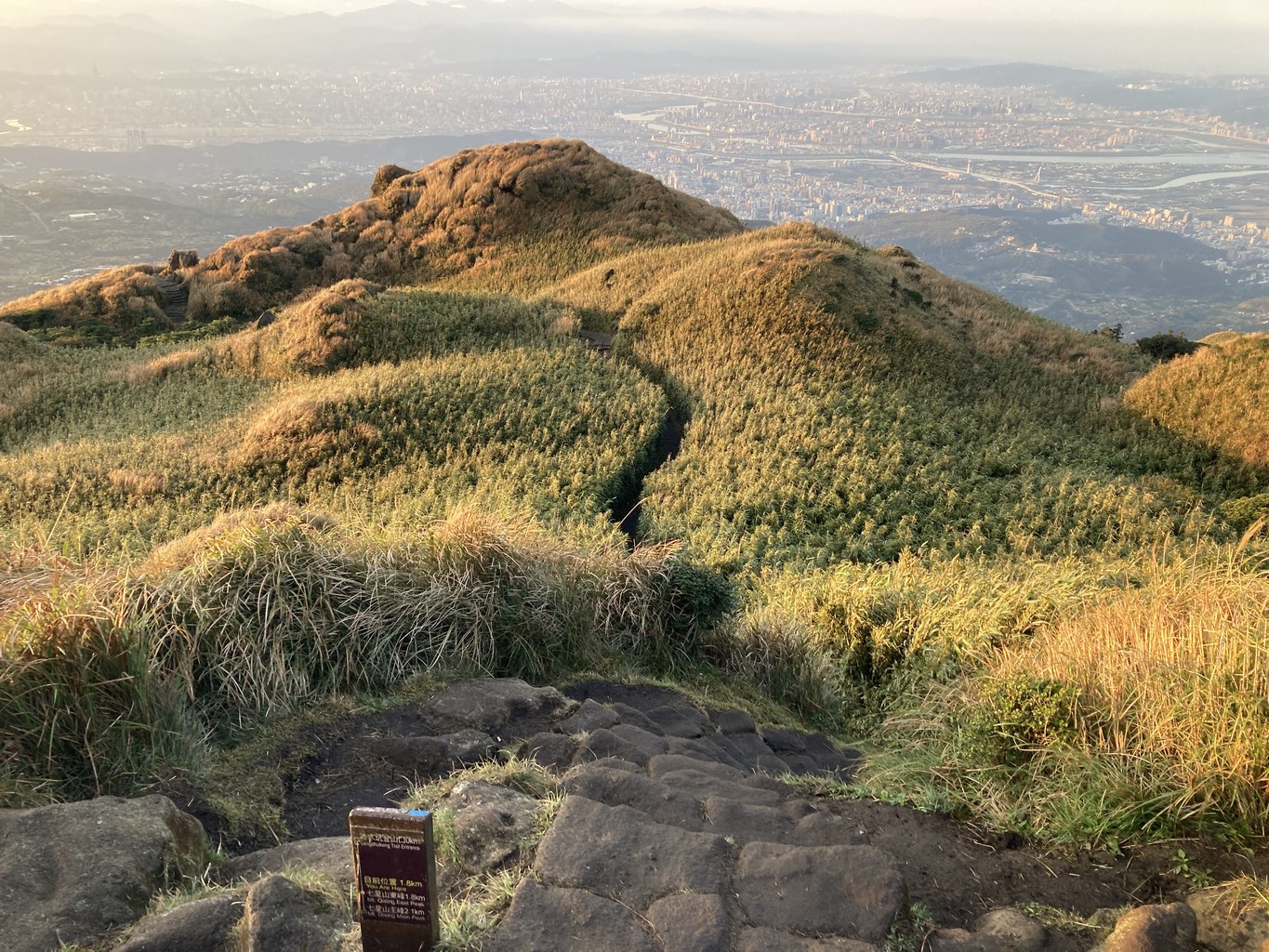
The third stage is an absolute highlight of the trail. It leads from the parking lot in Xiaoyoukeng over the Main (1118 m) and East (1106 m) peaks of the 七星山 Qixing “Seven Star” Mountain. Solfataras emit hot fumes as I climb up the trail, surrounded by the ubiquitous silver grass.
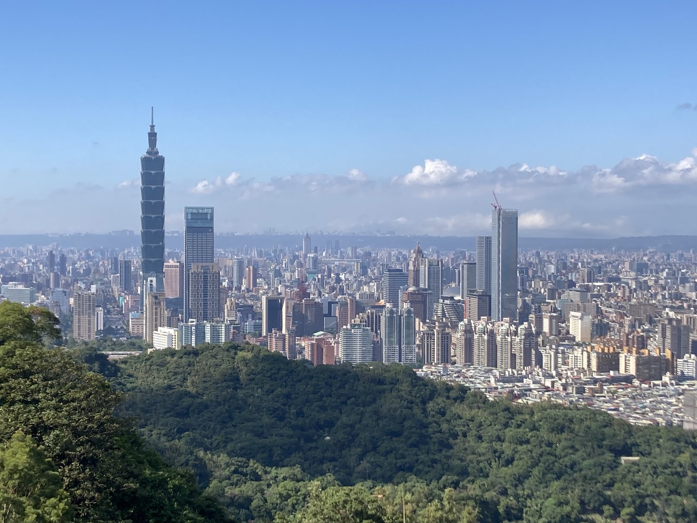
From the top, views open up in all four directions. In the distance, I can clearly spot Taipei 101 through the morning fog. The best times to come here are sunrise or sunset (both logistically challenging due to the lack of public transport during off-hours). On a clear day, the views are magnificent.
After crossing the highest point of Taipei, I descend down the other side of the mountain. Near the 冷水坑 Lengshuikeng Visitor Centre (742 m), I treat my legs to a well-deserved soak in a pool outside the public hot spring, just next to the main road.
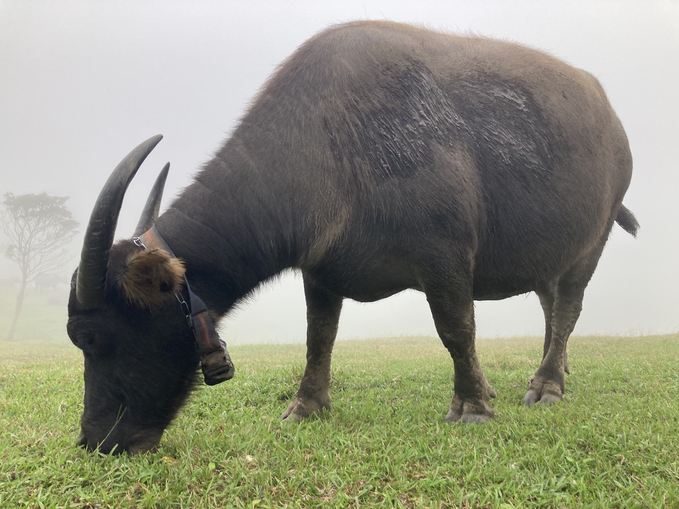
With renewed strength, I hike over the hills of 擎天崗 Qingtiangang Grassland. Water buffalo can roam freely in large parts of the National Park. At this busy spot, a fence keeps the beautiful animals at a distance; elsewhere, you are responsible for giving them respectful space.
Hiking past 石梯嶺 Shiti Ridge (862 m) and 頂山 Dingshan (768 m), the goal of the third stage is the road in 風櫃嘴 Fengguizui (598 m), a popular route for cyclists and mountain runners who push themselves up in large numbers.
I’m happy the weather has held up, but my lucky streak ends soon after. During the long wait for the bus, it begins to rain buckets. Soaked through and through, I chug back towards town in a small minibus, crammed between other hikers. I’m wet and cold but happy about completing this fantastic section of the trail.
The most difficult parts are over; sections 4 to 7 include less elevation gain and are generally easier to complete.
Stage 4
From Fengguizui, I leave the hills of Qixing and Qingtiangang. Following a small trickle through the dense forest, I trudge towards 梅花山 Meihuashan (643 m), today’s highest point. From here, my path leads gently downhill through thick greenery.
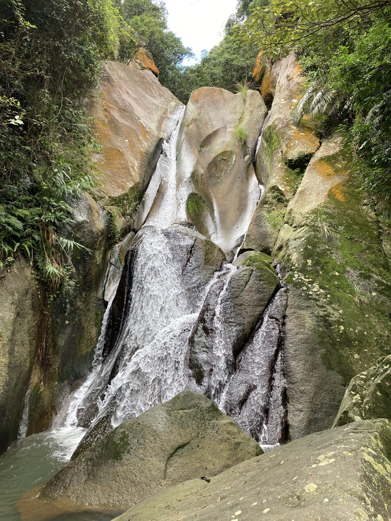
I leave the forest and reach a small agricultural settlement at the foot of the mountain. Views of Taipei’s skyline open up from the observation deck of 圓覺寺 Yuanjue Temple. Passing the Yuanjue Waterfall, I follow the path down to 大湖 Dahu, a tranquil district in the East of Taiwan’s capital.
Stage 5
The fifth stage takes me from Bishan Temple (242 m) in Neihu westwards back towards central Taipei. The 老地方觀景平台 Old Place Viewing Platform offers a good view of 松山 Songshan Airport, a hub for regional flights to other destinations in Taiwan, such as the islands of 金門 Kinmen and 馬祖 Matsu near the Chinese Mainland.
The Northern part of the Taipei Grand Trail ends near 劍潭 Jiantan MRT station.
Stage 6
The next stage is another highlight, a comparatively easy walk with beautiful views of the Taipei skyline for almost its entire length. In the centre of my vista sits the Taipei 101 skyscraper, one of the city’s landmarks and the tallest building in the world from 2004 to 2009.
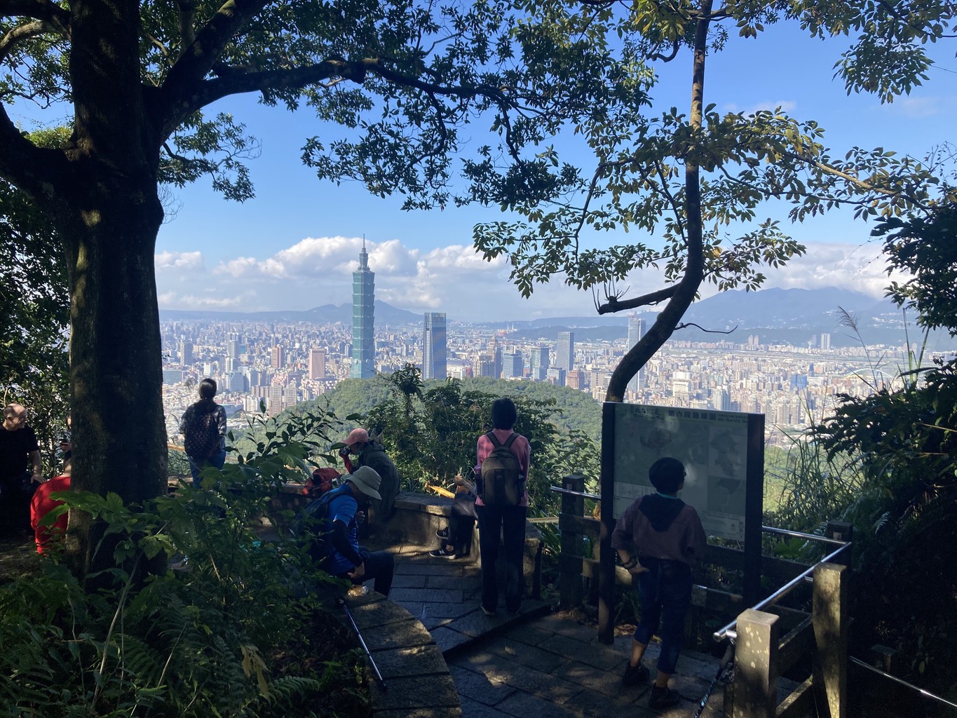
Tucked away near 中華科技 大學 China University of Science and Technology, the trail starts in 南港 Nangan (Bus 620). After about three kilometres, I reach the top of 九五峯 9-5 peak at 375 metres. Marked by a large bolder with red characters painted on it, it’s a popular photo spot with Taipei 101 in the background.
There are options to extend the hike, for example, by climbing some of the 四獸 Four Beasts (象山 Elephant Mountain, 虎山 Tiger Mountain, 獅山 Lion Mountain and 豹山 Leopard Mountain) nearby. The main route of the trail skips these and winds down to 捷運麟 Linguang MRT station instead.
Stage 7
The last part of the Taipei Grand Trail is a stroll along the roads of 貓空 Maokong Mountain. From Linguang station, I climb up to Zhinan Temple (264 m), which offers an excellent view of the hills below. It’s one of the stations of the cable car line that connects Taipei Zoo with the famous Maokong mountain, widely known for its many tea plantations.
From the top of Maokong Station (299 m), I walk along the Camphor Tree trail. I reach Zhongshan Temple and the Start/End point (in my case, the endpoint) of the Taipei Grand Trail soon after.
Bonus stage
As a bonus, there is also a cycling section: a 38-kilometre route follows the Tamsui River back to the starting point in Guandu.
As a reward for completing all seven hiking stages, I pick up my certificate and the official Grand Hike towel as a souvenir from the 台北市政府工務局大地工程處 Geotechnics Office of the City of Taipei.
To record my progress, I have used the 健行筆記 Hiking Biji App, which also provides numerous other route suggestions and information about hiking in Taiwan. Alternatively, you can also “prove” the completion of the hike the old-fashioned way using photos. Taiwan is definitely at the forefront of gamifying hiking, and young and old alike are keen to participate.
Taipei is in the fortunate position of having a large number of worthwhile and varied hiking trails near the city. Whether leisurely in seven - or more - daily stages, in more ambitious variants or even as a marathon day tour, with the Grand Hike, the city has managed to make some of the most beautiful trails accessible to everyone.
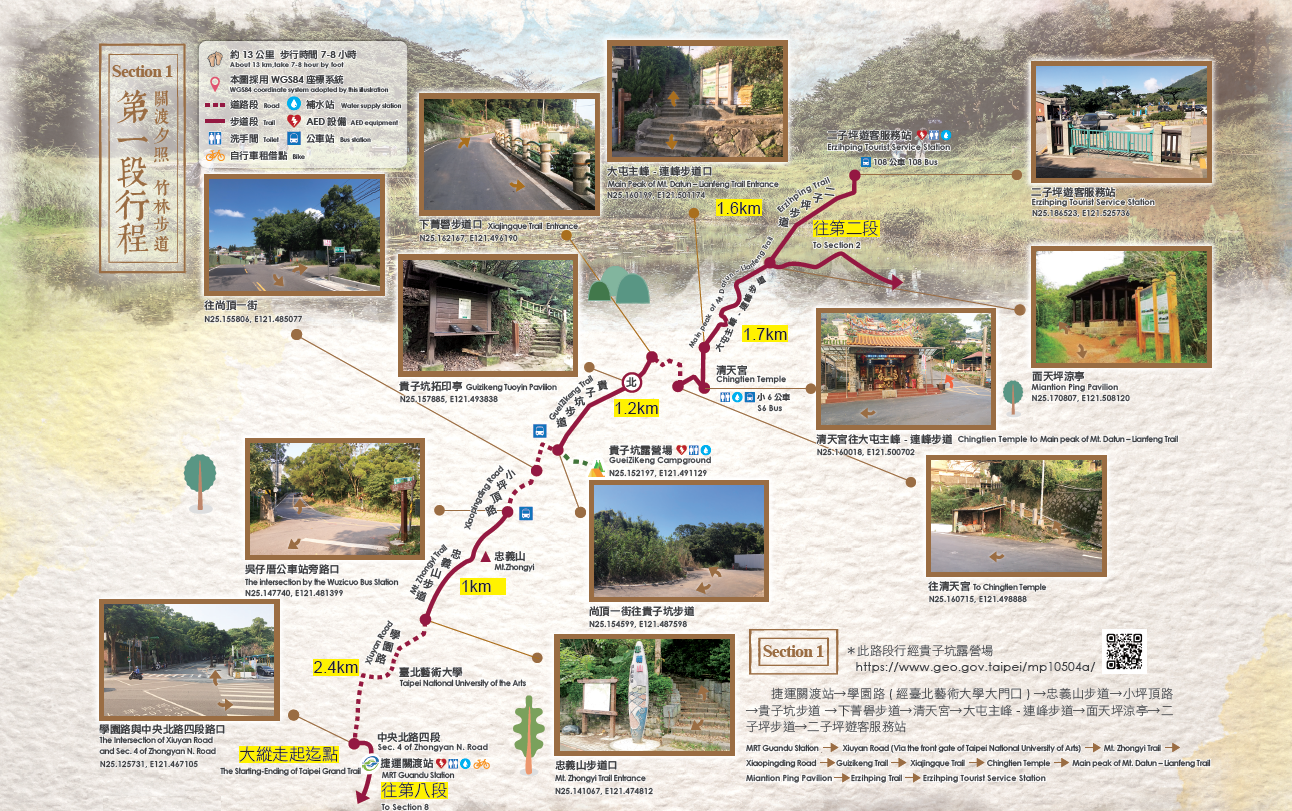
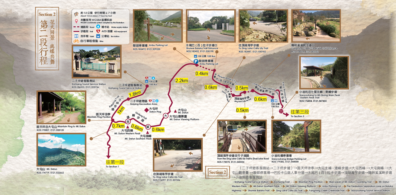
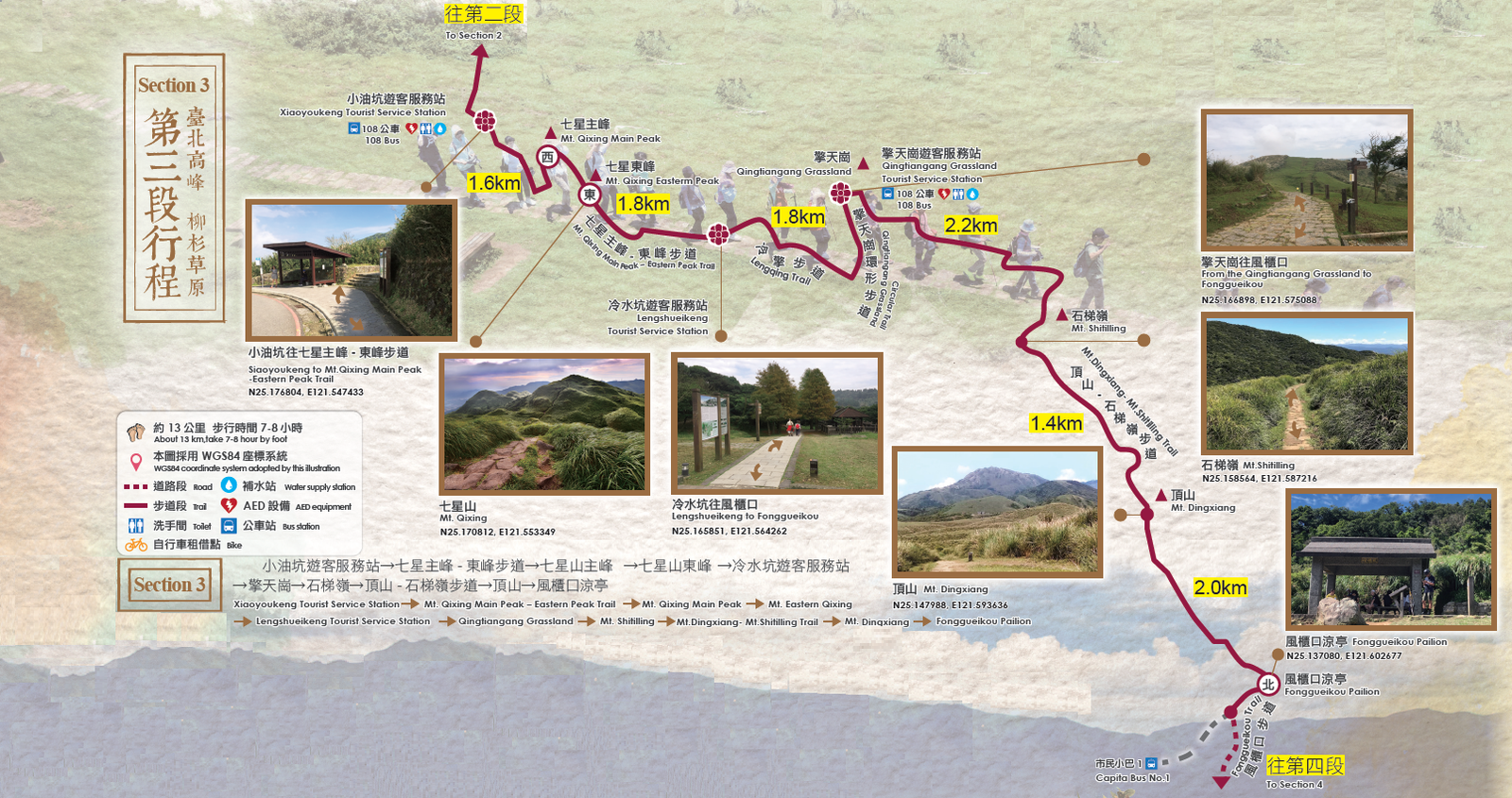
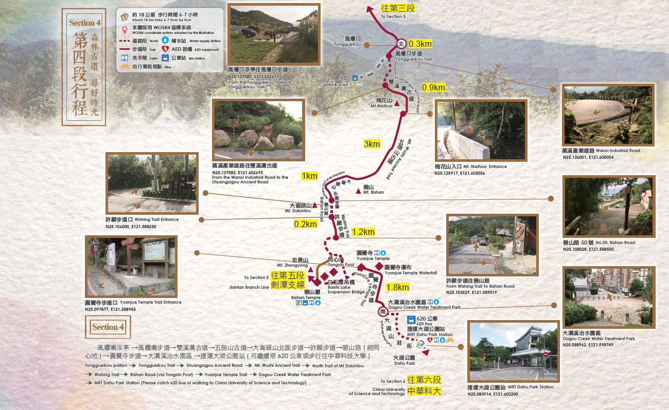
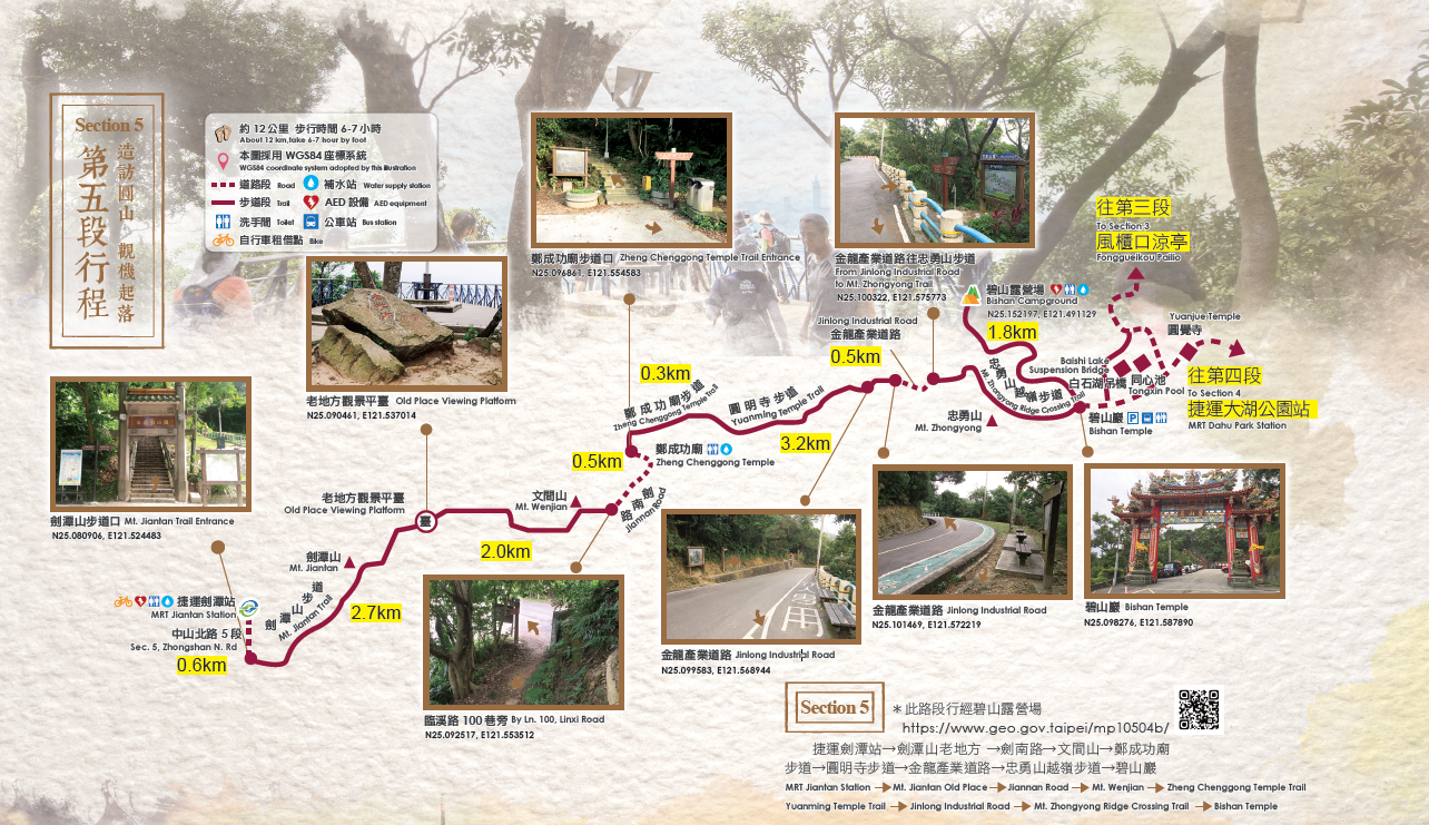
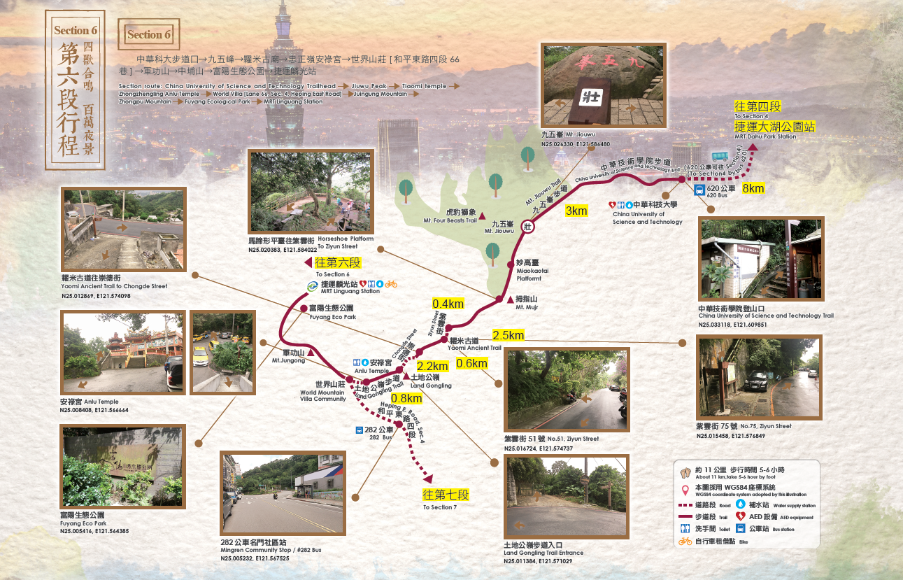
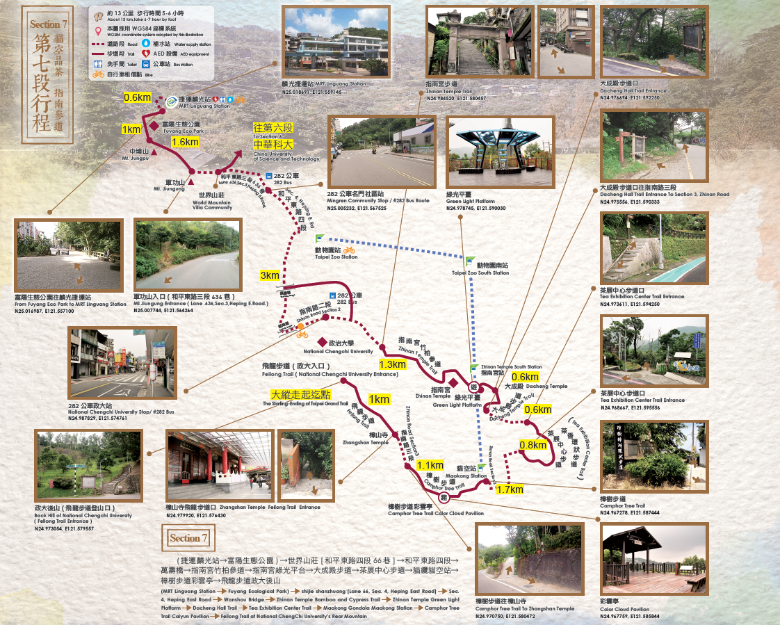
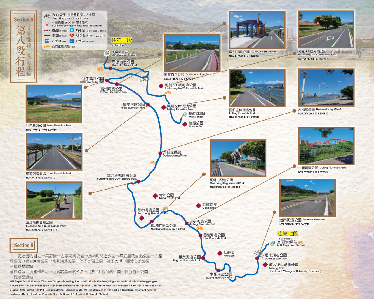
The maps have been taken from the webpage of the Geotechnical Engineering Office.